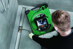
The 3D-GeoSense system from IBAK uses a sensor in the camera to provide users with a 3-D map of the lateral. The XYZ coordinates can be determined when the camera is moving both forward and backward, immediately providing the operator a real-life site plan with the width, length and elevation data of the lateral being inspected. It can be used in push or lateral launch applications. Additional third-party software is required. 800/656-4225; www.rapidview.com.