Order Digital Reprints
Filed Under
Sign Me Up!
Sign up Digital!
Subscribe to Print!
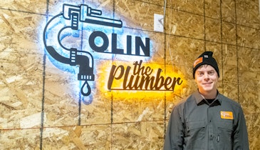
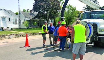
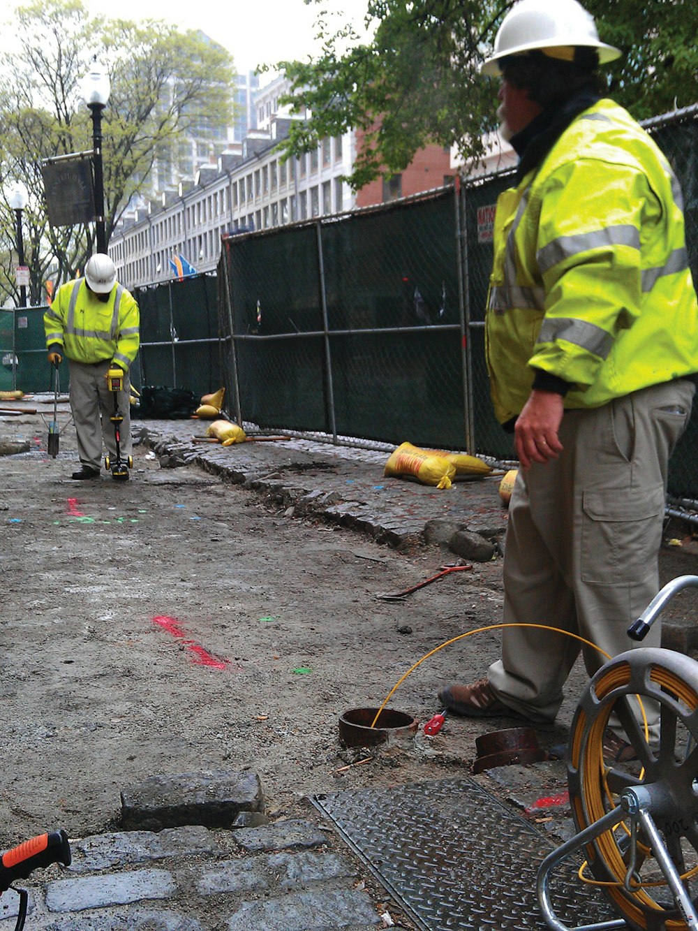
Kevin Conlon locates and maps underground utilities along a street in New London, Connecticut.
Interested in Location/Detection?
Get Location/Detection articles, news and videos right in your inbox! Sign up now.
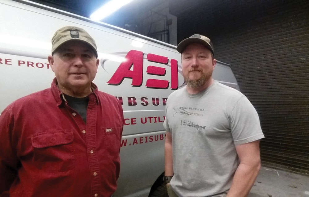
Location/Detection + Get AlertsWhen Pat Aubin founded AEI Subsurface more than four decades ago, the company’s primary focus was site preparation for residential construction projects. But today, AEI mostly focuses on technologically advanced utility locating and mapping.
How AEI (which stands for Aubin Excavating Inc.) evolved from force to finesse and from heavy machinery to sophisticated high-tech equipment underscores the importance of spotting and capitalizing on changing business conditions and underserved markets. It also shows how the older generation in family-run businesses can benefit from embracing ideas proposed by the next generation — in this case, Aubin’s son, Nick, now a co-owner of the Warren, Rhode Island-based company.
“I knew we had to do something different, but Nick had the knowledge to figure out exactly what that was,” says Pat, age 65. “The takeaway is you need to listen to your kids. You spend such a large part of your life teaching your children, but at some point, the student becomes the teacher.”
For AEI, that point came in 2003 after Nick graduated from the New England Institute of Technology with a degree in electrical engineering. He had worked as a laborer and equipment operator for his father as a teenager, but he never planned on working in the family business. However, he was intrigued by a dilemma confronting his father: Excavating had become such a high-cost and high-liability industry that he wanted to drive the company in a new direction.
Utility locating seemed like a good direction to go. Pat had frequently encountered instances of inaccurate utility locating, so an underserved market niche existed. Moreover, Pat had compiled years of utility line installation experience, so he knew how underground utilities are laid out — an important market differentiator and competitive advantage.
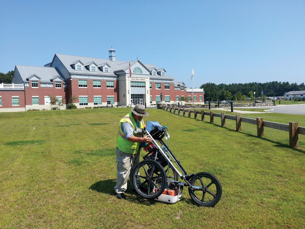
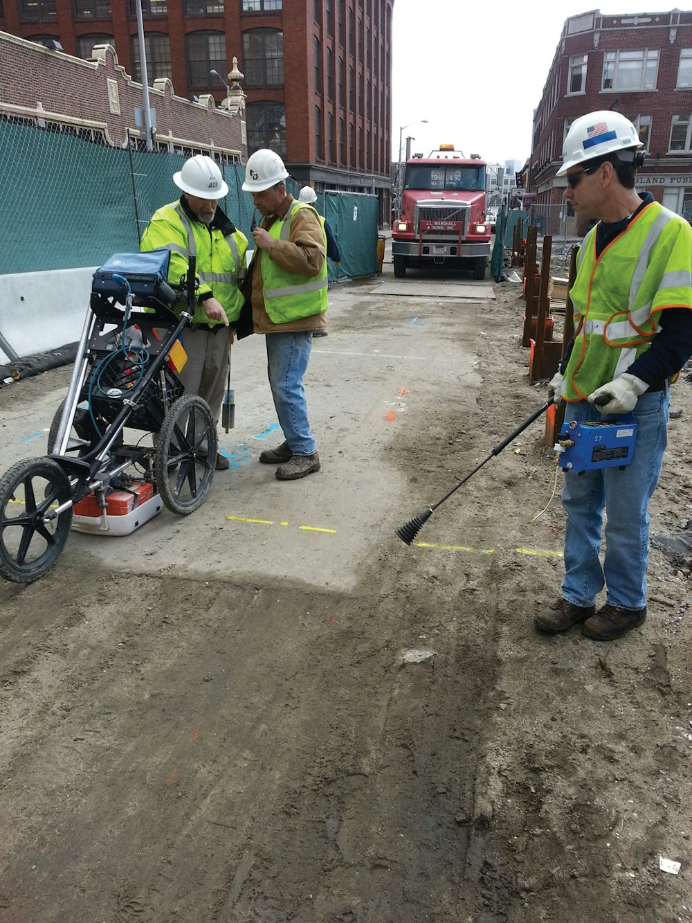
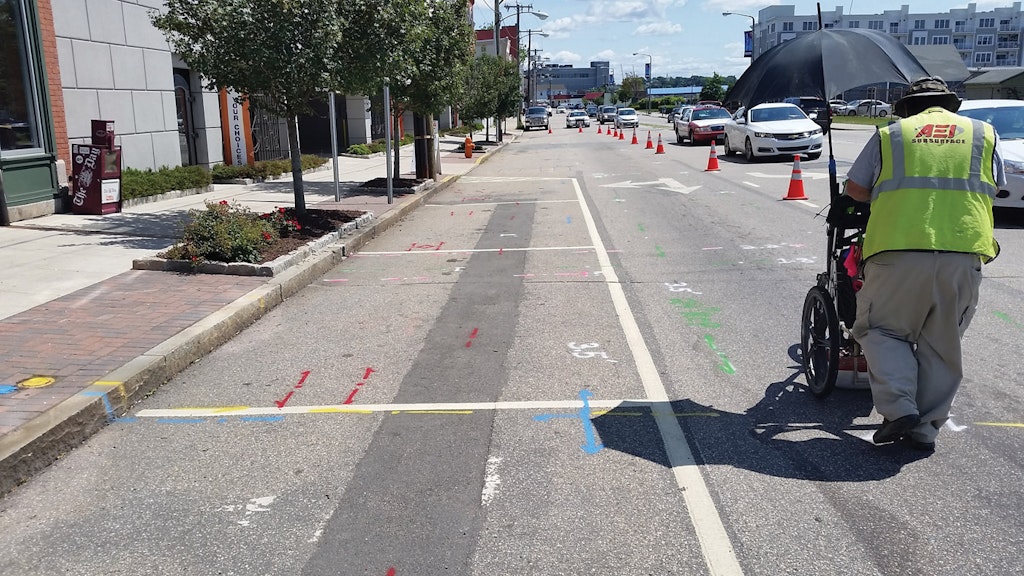
After Nick did some research, the company invested in an electromagnetic (EM) utility locating system made by Vivax-Metrotech and a ground-penetrating radar (GPR) system manufactured by Geophysical Survey Systems.
High-tech detection
EM technology relies on a transmitter, which emits a frequency selected by the operator, and a receiver, which is set to detect those frequencies. The transmitter sends an EM current in the form of a specific radio frequency through pipes or cables, typically via a connection to an above-ground access point. As such, a receiver tuned to the same frequency enables the operator to follow the pipe. An operator should theoretically be able to trace its paths as long as the line being traced is metallic and continuous.
GPR is an entirely different animal. It operates like a fish-finder device, except that it transmits EM energy into the ground. These signals reflect back to the receiver, where a processor and software interpret what it’s “seeing.” Different materials possess contrasting electrical properties. The greater the contrast between two materials, the stronger the reflections show up on the GPR’s monitor.
It takes intensive training and field experience to learn how to interpret the images. “It’s a great tool for determining possible anomalies and other conductive and nonconductive utilities that may not exist on facility plans,” Nick explains. “But it’s not infallible technology. For example, GPR signals transmit well in resistive materials, such as sand and gravel, but soils containing clay-, ash- or cinder-laden fill — or fill saturated with brackish or otherwise electrically conductive groundwater — can cause GPR signal attenuation and loss of target resolution. Overall, it’s another tool in our toolbox. It’s useful for finding (nonmetallic) water pipes that aren’t conductive.”
AEI typically uses these two main technologies to develop a complete underground “picture.” GPR complements EM locating because it can detect nonmetallic lines — think plastic, clay or reinforced concrete, for instance — that the EM technology can’t detect.
In addition, researching utility records prior to locating and mapping is a must. “You have to know what utilities you’re dealing with in order to apply each technology,” Nick points out. “We first use the EM system and mark the utilities and then use GPR to survey the area and find unknown objects and anomalies.”
There’s also a physical aspect to utility locating. AEI also does legwork, performing visual inspections that may include examining manholes and catch basins. Because the technology isn’t completely foolproof, physical inspections are essential. “Sometimes we open a manhole and find 10 different lines running through it, all different heights and (diameter) sizes,” Nick says. “Some of them might be abandoned, and some still in use. All this research goes into the mapping. It’s another piece of the puzzle.”
Building a base
To establish a customer base, AEI concentrated primarily on locating utilities on private property, usually military and industrial complexes as well as state- and federal-owned facilities. Because many state and federal jobs specify GPR technology, the investment in a GPR system “opened a lot of doors for us,” Nick says.
As the company built a reputation for accurate locating and mapping, business slowly grew, largely through word-of-mouth referrals. “As it grew, it just kind of took over our business,” Nick notes. “The more we did that kind of work, the more clients realized a need for it.”
Pat’s knowledge of underground utility installation provided a competitive advantage because he understood nuances of utility lines that contractors without installation backgrounds might overlook. For example, when contractors install 18- or 20-foot-long sections of water pipe, they’re supposed to include bronze wedges — small metal devices that bridge the nonmetallic connection joints between pipe sections and, in effect, provide a continuous metal connection from pipe section to pipe section.
Wherever the conductive wedges weren’t installed, the EM receiver loses the pipe’s signal, which often results in the receiver tracing a nearby pipe instead — an occurrence known as signal bleed. “If the receiver doesn’t have a conductive line to follow, it’ll jump to something else,” Pat says. “So if someone doesn’t know how water pipes are installed, they can’t locate it as accurately.”
Correctly analyzing the data from EM and GPR technology is as much art as it is science, and Kevin Conlon, the company’s only employee aside from the owners, is an expert operator. Pat says, “He’s very essential to our operation.”
Experienced operators like Conlon are just as important as the technology itself. “You’re looking at a blank slate and then using research and the technology to develop a full picture of what’s down there,” Nick explains. “It’s more involved than just throwing equipment at it and getting the job done. On the other hand, we couldn’t do as much without the technology. Using witching sticks (divining rods) is not a viable method of utility locating.”
Follow the money
When Pat started his business in 1973, he hardly could’ve imagined doing anything except operating heavy equipment. Upon graduating from high school, the heavy-equipment-crazy teen bought an International 500 bulldozer and started doing site prep work for new house construction. Prompted by a road-construction and utility-installation boom, he transitioned into road construction in the 1980s.
“We’d be working on residential construction, and contractors would ask me what I’d charge to build roads,” Pat says. “That, in turn, led to installing water and gas lines and other underground utilities. What I did was follow the market, follow the money.”
AEI even did vacuum excavating for a while, but Pat says it eventually became more economical to subcontract the air excavation work, so the company sold the machines. “By subcontracting this service, we get professionals (operators) and we only get them when we need them,” he says, noting that subcontracting significantly reduces the company’s labor, equipment and insurance costs.
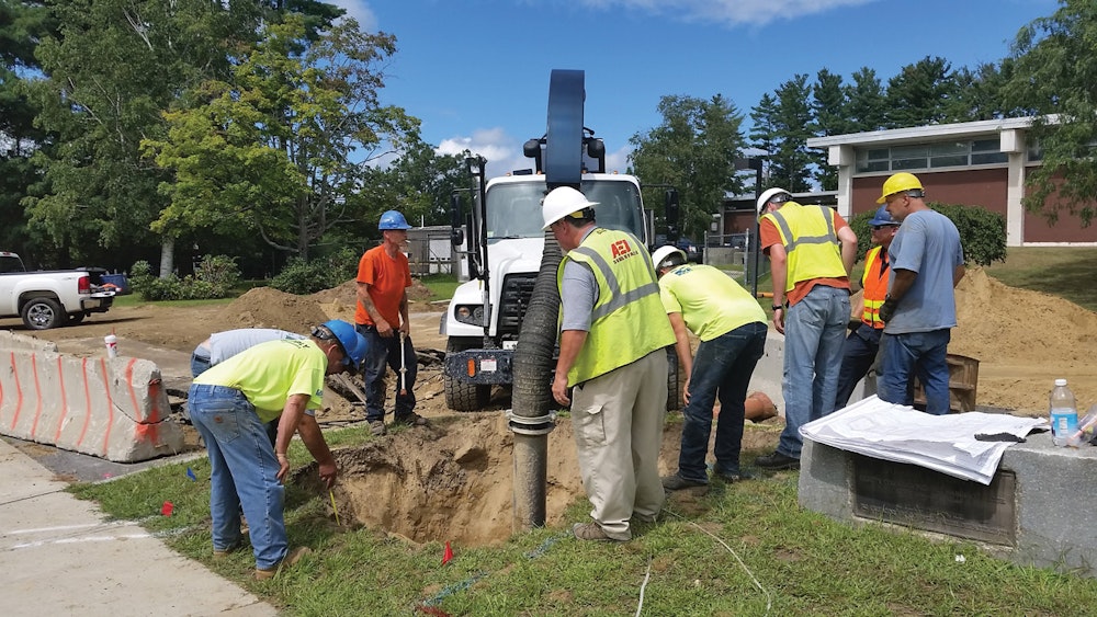
The company still does some heavy-equipment excavation. To support that service, AEI owns two excavators, one backhoe and one bulldozer, all manufactured by John Deere. The company also owns an acoustic leak-detection system made by Hermann Sewerin GmbH.
Safety drives growth
The company’s growth is driven by a high demand for accurate utility locating and mapping as well as the need to replace aging infrastructure safely, without hitting a cluster of adjacent lines. “There’s so much stuff in the ground now. Things I never gave any thought about in the 1970s,” Pat explains. “Back then, when you saw a fire hydrant, you knew there was a waterline there. Now, there’s so much other stuff underground that there’s a high level of concern you’ll hit something that could kill someone.”
Just how complicated is it underground? To get an idea, Nick suggests envisioning a layered circuit board: “That’s what this is like, in a sense. And it’s not only existing utility lines for water, sewer, natural gas, fiber-optic communications and electric service — it’s abandoned lines, too. It’s one big maze.”
It would make sense that old utility records would show the locations of utility lines, but that’s usually not the case. Most records show utility lines only as they were designed, not as they were actually installed, and there’s usually big differences between the two because contractors deviate from the design when necessary. “The differences between the two can be shocking,” Nick says.
Military bases are particularly complicated. In addition to the typical utility lines, bases might also have steam, oil, communications and compressed-air lines. “It’s usually everything you can imagine, times two,” Nick says. The stakes are high at such facilities because they also include things like secure communication lines. Pat explains, “If you hit a fiber-optic cable on a naval base, you’ve got a problem,” he says. “There’s a huge cost involved if something goes wrong.” Moreover, at least three days ahead of a job, AEI has to submit the radio frequencies it plans to use so that military officials can ensure none of the frequencies will detonate ordinance on the bases.
Looking ahead, the Aubins expect to see continued growth as demand intensifies for replacing aging underground infrastructure. Excavation safety will also continue to play a role in driving growth. “If contractors know they can dig safely, there’s value there,” Pat says. “There’s a lot of liability if they don’t do their due diligence.
“I see nothing but growth for the next three to five years,” he continues. “But we need to keep controlling the quality of our work. I have no intention of running a three-ring circus just to make money. We like to do things right.”
Utility-line location systems steered firm into new market
When AEI Subsurface decided to ease away from excavation services in favor of utility line locating and mapping, co-owner Nick Aubin knew the company had to invest in reliable and precise systems in order to gain a foothold in this new market.
After doing in-depth research, Aubin concluded that two different kinds of technology would position the company for success: a ground-penetrating radar (GPR) system made by Geophysical Survey Systems and an electromagnetic (EM) detection system developed by Vivax-Metrotech.
Aubin says that the GPR system is not only reliable and accurate, but also offers different antenna configurations that make it more versatile. “You can use it for different target applications,” he explains. “We can combine traditional structural scanning with higher-frequency antennas to produce targets inside concrete, such as cables, rebar and conduits. We can even find voids in bridge decks. The versatility is exceptional.”
Another antenna does geophysical investigations, which can provide contractors with critical information such as how deep a bedrock ledge might lie underground. Without that knowledge, a contractor usually has to excavate, find the ledge, and then remove it with dynamite before digging farther. “Knowing the location of bedrock prior to excavation is critical,” Aubin says. “It can cut the cost of an excavation project in half because of all the time that’s saved.”
The EM system from Vivax-Metrotech provides a wide range of EM frequencies that makes it very versatile. “Its antennas and displays, which include current direction and bleed-over detection, are very well put together,” he says. “You can use it on any kind of conductive utility.”
Aubin also likes the unit’s ergonomic design, which makes it easier to use for long periods of time. “It’s not crazy heavy, and it’s very comfortable to use,” he explains. “That’s important because when you’re waving a receiver around all day, fatigue definitely can be a factor.” He says the unit is also very reliable, noting that it’s 10 years old and still provides accurate results.